UN
10 Norman Road
£ 267,000
Description
We don't have a Description for this property.
- Bedrooms
- 3
- Bathrooms
- 0
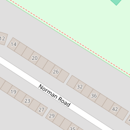
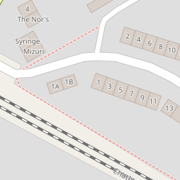


Leaflet © OpenStreetMap contributors
The heatmap indicates the level of crime in the area. The color of the heatmap indicates the crime severity and recency.
Metrics Year-on-Year
- Average area value
- 439,763.00 £Increased by 13.61 %
- Average area rental value
- 1,600.00 £/moIncreased by 24.71 %
- Est rental Yield
- 4.37 %Increased by 9.80 %
- Crime Rate
- 14.00 %Unchanged by 0.00 %
from 387,074.00 £
from 1,283.00 £/mo
from 3.98 %
from 14.00 %
Nearby Schools
| Name | Type | Ofsted | Distance |
|---|---|---|---|
| Callis Grange Children'S Centre | Children's Centre | 0.36 KM | |
| Callis Grange Nursery And Infant School | Community School | Outstanding | 0.42 KM |
| St Peter-In-Thanet Cofe Junior School | Voluntary Aided School | Good | 0.45 KM |
| St Joseph'S Catholic Primary School, Broadstairs | Academy Converter | Good | 0.48 KM |
| The Charles Dickens School | Academy Sponsor Led | Requires improvement | 0.89 KM |
Images
Nearby Streets
| Name | Average Price | Average Sqft | Distance |
|---|---|---|---|
| St. Peters Court | £ 493,643 | 0 | 0.00 KM |
| Albion Road | £ 358,750 | 0 | 0.00 KM |
| Poplar Road | £ 231,250 | 0 | 0.00 KM |
| Parkland Court | £ 0 | 0 | 0.00 KM |
| Napier Road | £ 250,000 | 0 | 0.00 KM |
Nearby Transport
| Name | NLC | TLC | Distance |
|---|---|---|---|
| Broadstairs | 5006 | BSR | 1.10 KM |
| Dumpton Park | 5034 | DMP | 2.44 KM |
| Ramsgate | 5023 | RAM | 3.72 KM |
| Margate | 5018 | MAR | 6.34 KM |
| Westgate-On-Sea | 5195 | WGA | 9.86 KM |
Nearby Listings
| Address | Price | Type | Score | Distance |
|---|---|---|---|---|
| Norman Road, Broadstairs, Kent, CT10 | £ 250,000 | BUY | Unknown | 0.02 KM |
| Norman Road, St. Peters, Broadstairs, Kent | £ 185,500 | BUY | 6 / 10 | 0.04 KM |
| Norman Road, St. Peters, Broadstairs, Kent | £ 280,000 | BUY | 6 / 10 | 0.04 KM |
| Norman Road, St. Peters, Broadstairs, Kent | £ 178,000 | BUY | 8 / 10 | 0.04 KM |
| Norman Road, St. Peters, Broadstairs, Kent | £ 325,000 | BUY | 7 / 10 | 0.04 KM |
Nearby Properties
| Address | Price | Distance |
|---|---|---|
| 12 Norman Road | £ 232,500 | 0.00 KM |
| 50 Norman Road | £ 265,000 | 0.00 KM |
| 10 Norman Road | £ 267,000 | 0.00 KM |
| 26 Norman Road | £ 107,500 | 0.00 KM |
| 76 Norman Road | £ 240,000 | 0.00 KM |